Continuing on our Route 66 saga, we drove to Kingman, AZ utilizing one of the best-preserved segments of the original Route 66. It is one of the most fearsome obstacles for drivers, the hairpin curves and steep grades of Sitgreaves Pass.
Sitgreaves' Pass was first mapped out by Captain Lorenzo Sitgreaves in 1851 while on an expedition with a group of artists, topographers and naturalists to see if the Colorado and other rivers could be navigated by steam boat. From the top of the Pass at an elevation of 3,550ft (1,082m), we saw the Black Mountains. Driving on this Pass, the horseshoe curves are the steepest and winding roadway I've ever drove on.
Source: Western Arizona (Before)
View of Black Mountains
Current Road We've drove on
1929 postcard of a hairpin bend on Route 66, source; 66postcards.com
Our hairpin bend roadView of Black Mountains
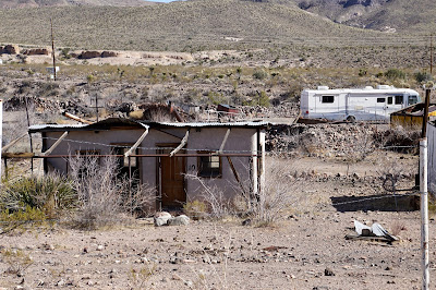
Along the way we stop and took photos of Ed's Camp. This Camp was founded in the 1920s by Ed Edgerton, who set up the Kactus cafe', a gas station, some campgrounds and related facilities to serve local miners.
Heyday photo Source: Western Arizona
What it looks like today
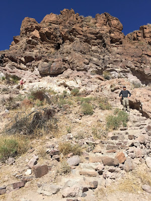
One more interesting stop was Shaffer Fish Bowl Spring located shortly past Ed's Camp on Route 66 heading West. A natural spring leads down to a basin where there are several gold fish. What was it use for? One report that I've read was that travelers sourced it for water to fill canvas bags or the radiator as they drove up the old highway. While we were there we've noticed many, many bees gathering water from the cool spring.
Thanks for reading and looking at our photos.


No comments:
Post a Comment